
Monitoring of Bridges
- Subheading: Satellite monitoring reveals significant differential movement
The Vienības Bridge in Daugavpils, Latvia, is an approximately 300-metre-long road bridge spanning the Daugava River and serves as a critical transportation link for the city and surrounding region. Authorities have already described the bridge as being in poor technical condition and have secured European funding for its planned reconstruction.
Sille.Space satellite-based monitoring has identified significant structural movement on the bridge. Using Sentinel-1 Synthetic Aperture Radar (SAR) data from the European Space Agency (ESA) and the Interferometric SAR (InSAR) technique, analysts detected measurable displacement affecting multiple parts of the structure.
The most notable finding is a differential displacement exceeding 35 millimetres per year in the northern section of the bridge. Differential displacement is particularly important because it indicates that various parts of the structure are moving at different rates, potentially creating additional stresses within the bridge's foundations, supports, bearings, and deck. The analysis also identified measurable displacement affecting both the northern and southern sections of the bridge, with movement patterns that appear to indicate subsidence, or downward settlement, in several locations.
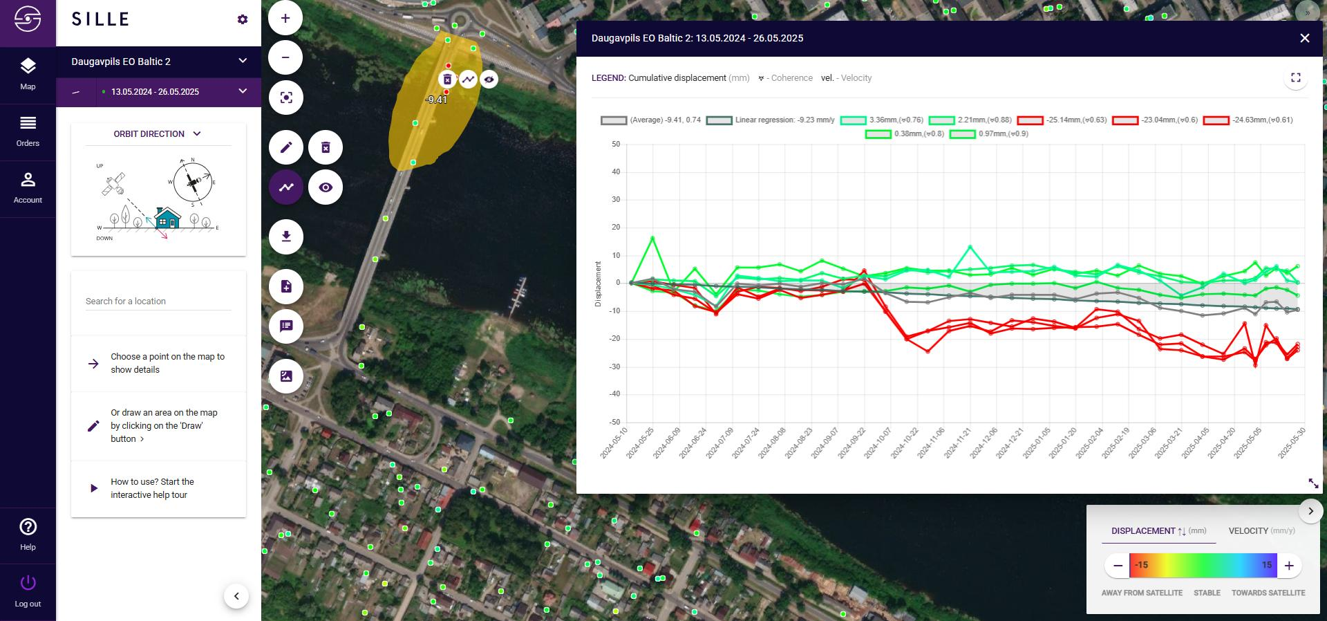
The findings are especially noteworthy because a similar satellite-analysis pattern was reportedly observed on the Carola Bridge in Dresden, Germany, prior to its collapse on 11 September 2024. The collapse of the Carola Bridge attracted international attention because a section of the structure failed unexpectedly. Fortunately, no vehicles were on the affected span at the time, and there were no fatalities, injuries, or significant collateral damage.
It is important to emphasize that similar displacement signatures do not mean the Vienības Bridge will experience the same outcome. Every bridge has unique design characteristics, foundations, construction materials, maintenance histories, and environmental conditions. However, the comparison demonstrates how satellite-based deformation monitoring can provide valuable early warning indicators that merit closer investigation through detailed engineering assessments.
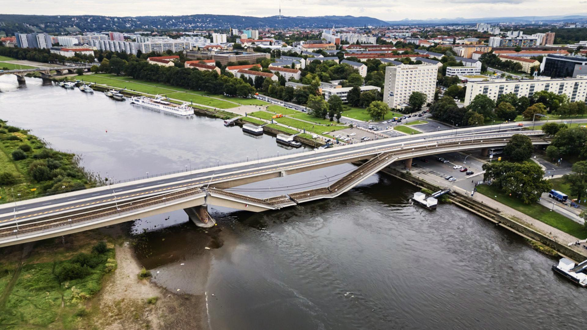
Image source: euronews.com
While the InSAR findings alone do not indicate an immediate safety risk, they provide another layer of evidence suggesting that the bridge should remain a priority for infrastructure investment and engineering review. As infrastructure across Europe continues to age, combining traditional engineering inspections with advanced Earth-observation technologies may become an increasingly important strategy for detecting risks before they develop into major safety concerns.
https://www.euronews.com/my-europe/2024/09/12/major-bridge-partially-collapses-into-river-in-dresden
https://www.dw.com/en/germany-bridge-in-dresden-collapses-into-elbe-river/a-70185172
Case Studies
Underground mine
Mining sites, surrounding infrastr...
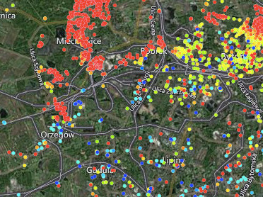
Bytom & Chełm Śląski, Poland Case Background Poland mines millions of tons of coal every year accounting for just over half of the country's ene...
Read moreOil Reservoir Monitoring
Oil reservoir deformation monitori...
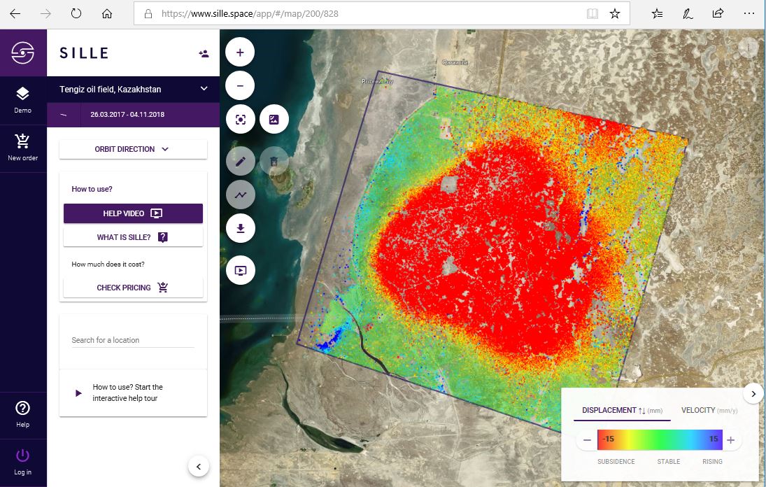
Oil reservoir deformation monitoring in the Tengiz oil field, Kazakhstan. Case Study Background Discovered in 1979, the Tengiz oil field is the sixt...
Read moreLand Subsidence Monitoring
Wide Area monitoring, City, Port,....
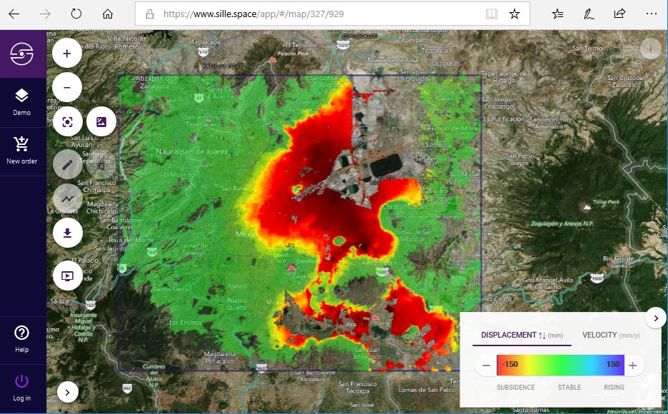
Long-term land subsidence in Mexico City Case Study Background Land subsidence is one of the main hazards in engineering and construction. Urban lan...
Read moreTunneling Monitoring
Wide area monitoring
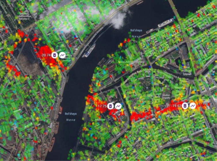
Tunneling monitoring, Saint Petersburg, Russia Case Study BackgroundMonitoring surface deformation to ensure the stability and safety of the undergro...
Read moreTailings Dam Monitoring
Sille.Space assessments could have...
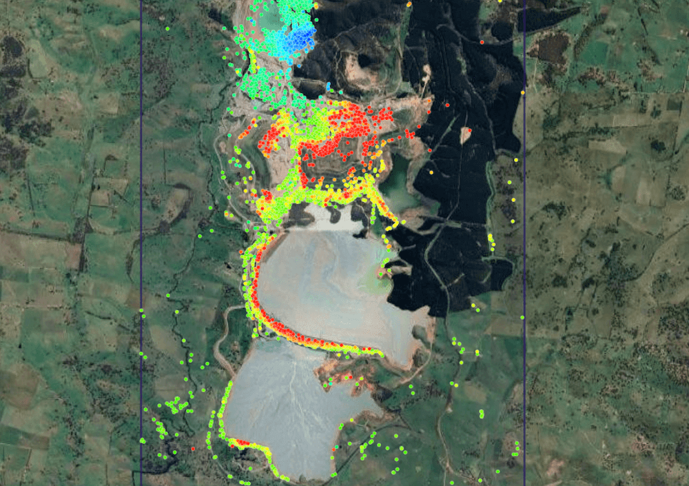
Newcrest’s Cadia Hill gold mine tailings dam, Australia. Continuing with our case-study series, in 2018, a section of Newcrest’s Cadia Hill gold ...
Read moreLevelling-benchmarks
Use of Sille.space, City of Tallin...
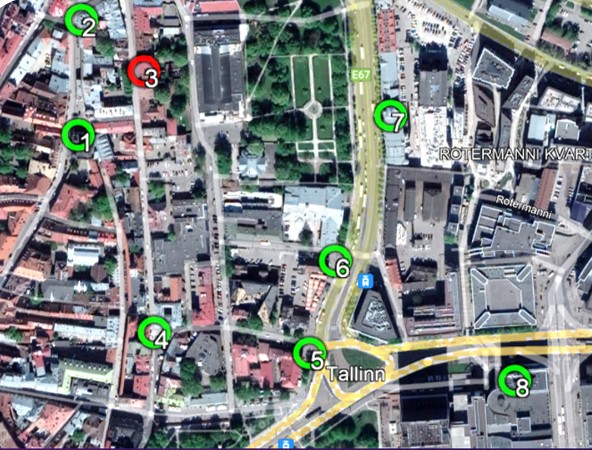
Levelling-benchmarks Tallinn, Estonia Case BackgroundThe complementary use of satellite radar interferometry (InSAR) with traditional systems has be...
Read moreMonitoring of Bridges
Satellite monitoring reveals signi...
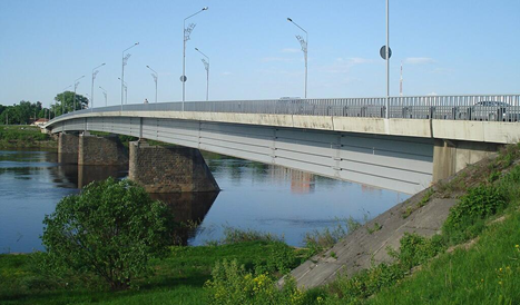
The Vienības Bridge in Daugavpils, Latvia, is an approximately 300-metre-long road bridge spanning the Daugava River and serves as a critical transpor...
Read moreMonitoring of Unauthorized Minings
Detection of illegal minings
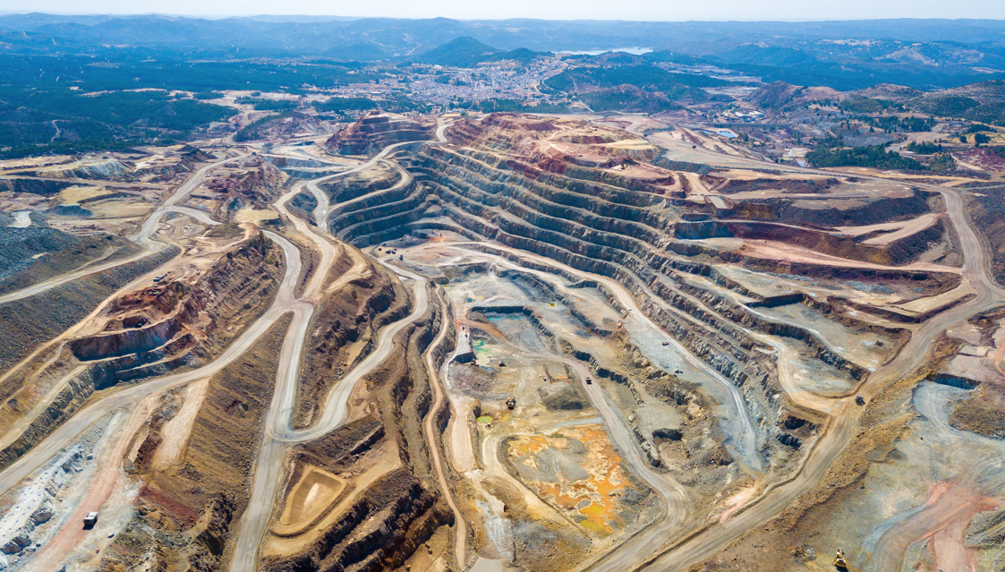
We help to detect potential mining activities using high-resolution optical satellite imagery and advanced geospatial analysis algorithms. This soluti...
Read more